
Page 245 - Ebook HTKH 2024
P. 245
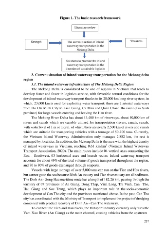
Figure 1. The basic research framework


                        3. Current situation of inland waterway transportation for the Mekong delta
                  region
                        3.1. The inland waterway infrastructure of The Mekong Delta Region
                        The Mekong Delta is considered to be one of regions in Vietnam that tends to

                  develop faster and faster in logistics service, with favorable natural conditions for the
                  development of inland waterway transport thanks to its 28,000 km long river system; in
                  which, 23,000 km is used for exploiting water transport; there are 2 arterial waterways
                  from Ho Chi Minh City to Kien Giang, Ca Mau and Quan Chanh Bo canal (Tra Vinh
                  province) for large vessels entering and leaving the Hau river.
                        The Mekong River Delta has about 13,400 km of riverways, about 10,000 km of
                  rivers and canals which are capably utilised for transportation (rivers, canals, canals,
                  with water level of 1 m or more), of which there are nearly 2,500 km of rivers and canals

                  which are suitable for transporting vehicles with a tonnage of 50-100 tons. Currently,
                  the  Vietnam  Inland  Waterway  Administration  only  manages  2,882  km,  the  rest  is
                  managed by localities. In addition, the Mekong Delta is the area with the highest density
                                                                              2
                  of inland waterways in Vietnam,  reaching 0.61 km/km  (Vietnam  Inland  Waterway
                  Transport Association, 2020). The main routes include 04 vertical axes connecting the
                  East  -  Southwest,  03  horizontal  axes  and  branch  routes.  Inland  waterway  transport

                  accounts for about 49% of the total volume of goods transported throughout the region,
                  and 70 to 80% of goods exchanged through seaports.
                        Vessels with large tonnage of over 5,000 tons can run on the Tien and Hau rivers,
                  but cannot go to the sea because Dinh An estuary and Tien river estuary are all sediment.
                  The Dinh An - Song Hau maritime route has a length of 182.26 km, passing through the
                  territory of 07 provinces of An Giang, Dong Thap, Vinh Long, Tra Vinh, Can  Tho,
                  Hau  Giang  and  Soc  Trang,  which  plays  an  important  role  in  the socio-economic

                  development of Can Tho city and the provinces mentioned above. In the past, Can Tho
                  city has coordinated with the Ministry of Transport to implement the project of dredging
                  combined with product recovery of Dinh An - Can Tho waterway.
                        To connect the Tien and Hau rivers, the transport industry currently only uses the
                  Vam Nao River (An Giang) as the main channel, causing vehicles from the upstream


                                                                                                         237